
Tour des Ecrins, GR 54
Two weeks on one of the toughest treks in Europe.
In July 2021 my dad and I went to the south of France to do the GR 54, otherwise known as the Tour des Ecrins.
As the name suggests the trek circumnavigates the Ecrins Massif in the Alps. Its length is 174 km.
The GR 54 goes through the heart of the Ecrins National Park, which is quite unlike any other place in the Alps. It is a very wild and unspoilt area because there are no ski-pistes, road passes or cable cars. Wildcamping, which we mostly did, is allowed between 7 pm and 9 am.
The trek is rated as one of the hardest treks in Europe, with a total elevation change of over 14,000 m.

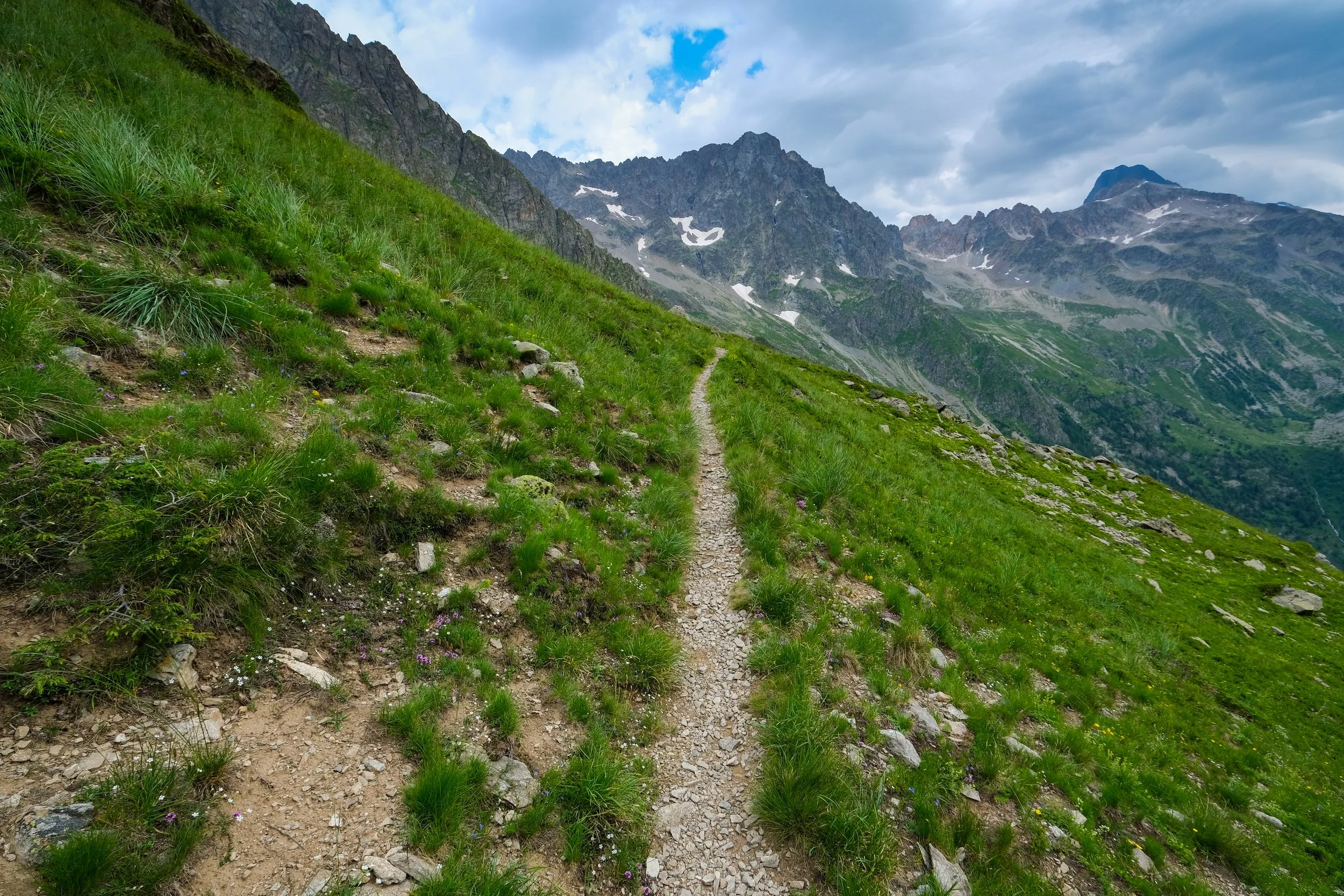
The first day leads over the Plateau d’Emparis. We spent most of the day in the mist. However, on the highest col (Col du Souchet, 2245m) of the day, the fog lifted slightly and we were able to see the mountains of the Ecrins (La Meije, 3984m) for the first time.

The peak of La Meije in close-up.

The village of Le Chazelet is passed on the first day en route to La Grave.

Early morning on the second day, leaving Villar d’Arene.

The GR 54 properly enters the mountains at Col d’Arsine, 2217m.

One of the locals.

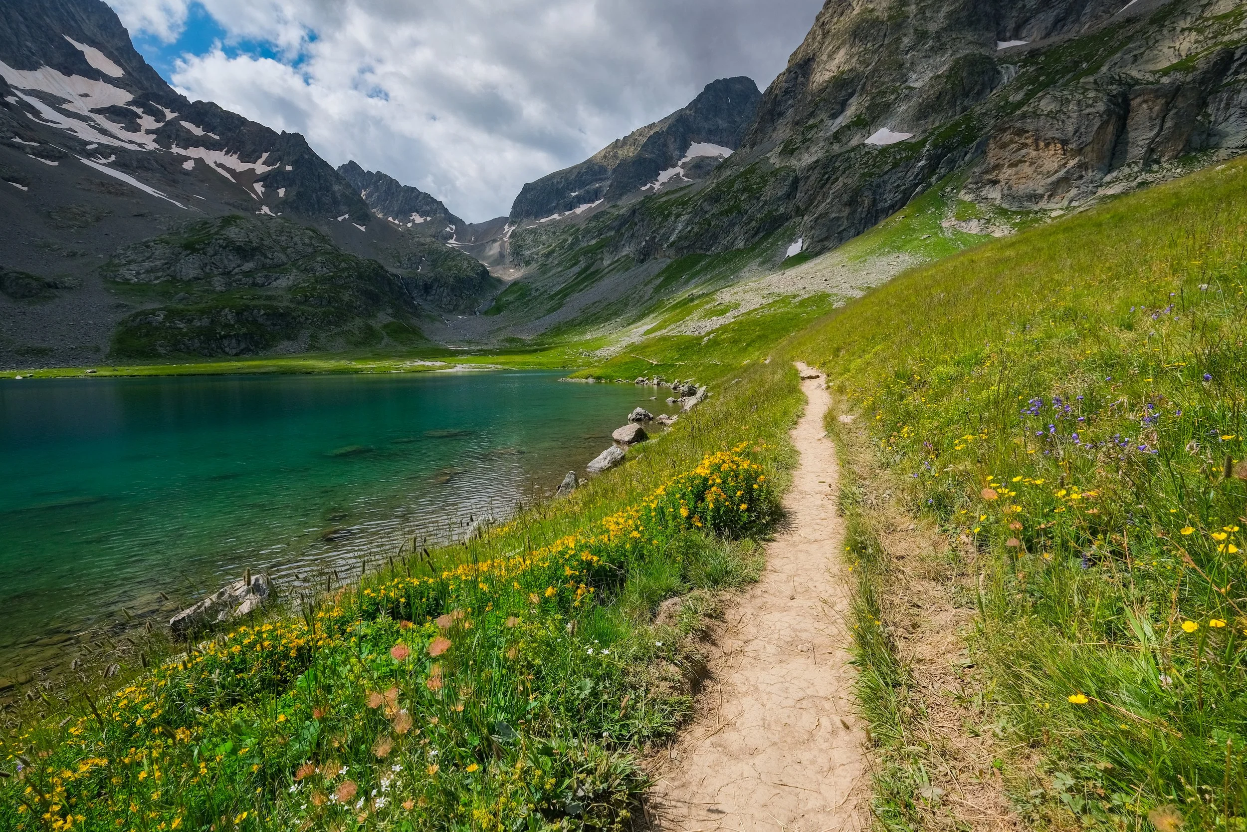
The descent from Col d’Arsine leads past the crystal blue waters of the Cirque d’Arsine.

Lac de la Douche, 1900m.

Descending from the Col de l’Eychauda (2433m) on the third day.

On the fourth day, the scenery changes as the GR54 moves into the heart of the Ecrins at Entre-les-Aigues, beyond Vallouise, to ascend to Col de l’Aup Martin (2761m).

Thunderstorm incoming, near Col de l’Aup Martin.

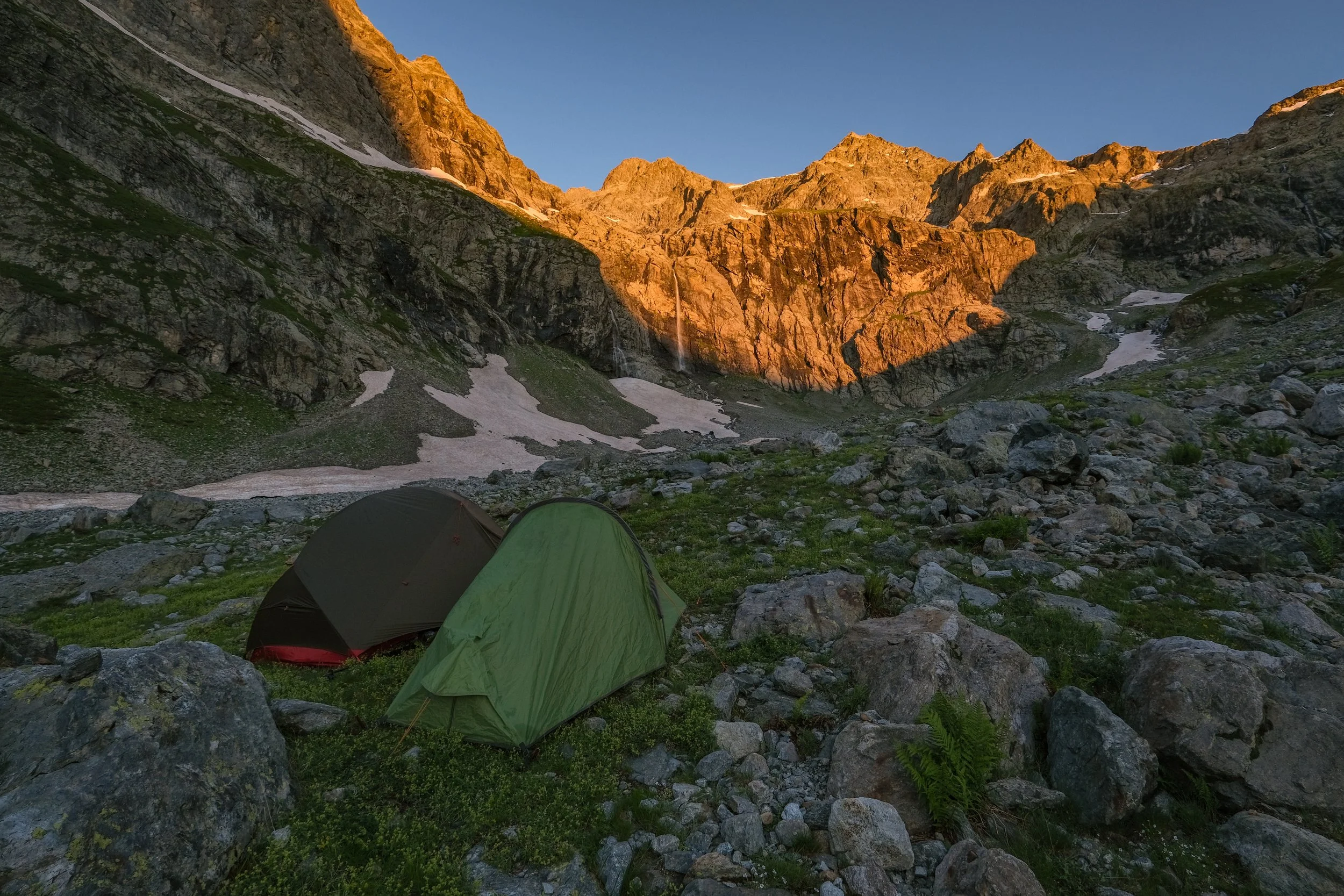
Camping under Glacier du Loup at around 2300m, near Col de l’Aup Martin.
Sunrise in a natural amphitheatre, start of the fifth day.

The last, very steep, pull up to Col de l’Aup Martin, at 2761m the highest point of the GR54.

Descending to the Vallée du Champoléon.

Camping in the Vallée du Champoléon.
Having lunch at Col de la Vallette, 2668m, the first of the three cols above 2600m that are crossed on the sixth day. The next one, Col du Gouiran, 2591m, can be seen in the centre.

Approaching Col du Gouiran.

Leaving Col du Gouiran for Col de Vallonpierre (2609m) which can be seen up the grey shale slopes on the right in the middle-distance.

Summit of Col de Vallonpierre (2609m). Col de Gouiran, the previous col, is the pass on the right side of the frame.
Looking back to the very steep descent (the zigzagging scar is the path) from Col de Vallonpierre.

The imposing summit of Le Sirac (3441m) from near the Refuge de Vallonpierre at dusk on the sixth day.

Sunrise on the seventh day, looking into the heart of the Ecrins.

The splendid village of La Chapelle-en-Valgaudemar, where we refuelled on day eight.

Looking back into Valgaudemar on day nine.
Looking to the distant Vercors massif at sunset near Lac Lautier, 2383m, where we camped on day nine.

Pic des Souffles, 3099m.

Our pitch at Lac Lautier.
Ascending Col de la Vaurze, 2500m, on day ten.

Summit of Col de la Vaurze. The village of Le Désert-en-Valjouffrey, our goal for this day, can be seen 1400m lower. This descent was a knee-breaker.

Looking back to the incredibly steep descent from Col de la Vaurze (the left gap in the mountains) to Valjouffrey on day 11.

Descending from Col de Côte Belle (2290m). The ascent of Col de la Muzelle, 2607m, is the steepest climb on the GR54. It was the next days’ objective and can be seen on the right.

Valsenestre from the descent of Col de Côte Belle. It is a wild valley, wolves roam here.

Ascending Col de la Muzelle, 2607m, on the final day.

Summit of Col de la Muzelle, looking back down the steepest part.

Col de la Muzelle, looking ahead at Lac de la Muzelle and the 1700m descent beyond to the valley at La Danchère, which would be the end of our GR54.
Passing Lac de la Muzelle at 2105m, looking back to Col de la Muzelle just before the weather turned. After this a long descent followed to La Danchère, which marked the end of the GR54.